


Chapelle st sixte

Nuance
User
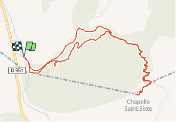

Length
3.8 km

Max alt
967 m

Uphill gradient
256 m
Km-Effort
7.2 km

Min alt
704 m

Downhill gradient
255 m
Boucle
Yes
Creation date :
2025-05-04 11:26:24.0
Updated on :
2025-05-04 15:00:31.027
1h38
Difficulty : Medium

FREE GPS app for hiking
 SityTrail
IGN / Geographical institutes
SityTrail Plus
The world is yours!
About
Trail Walking of 3.8 km to be discovered at Provence-Alpes-Côte d'Azur, Hautes-Alpes, Rochebrune. This trail is proposed by Nuance.
Positioning
Country:
France
Region :
Provence-Alpes-Côte d'Azur
Department/Province :
Hautes-Alpes
Municipality :
Rochebrune
Location:
Unknown
Start:(Dec)
Start:(UTM)
277428 ; 4925466 (32T) N.
Comments