


loubatous

micheleuvrard
User
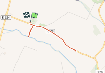

Length
3.4 km

Max alt
161 m

Uphill gradient
22 m
Km-Effort
3.7 km

Min alt
151 m

Downhill gradient
22 m
Boucle
Yes
Creation date :
2025-05-04 14:32:51.228
Updated on :
2025-05-04 15:27:21.305
54m
Difficulty : Easy

FREE GPS app for hiking
 SityTrail
IGN / Geographical institutes
SityTrail Plus
The world is yours!
About
Trail Walking of 3.4 km to be discovered at Occitania, Aude, Castelnaudary. This trail is proposed by micheleuvrard.
Positioning
Country:
France
Region :
Occitania
Department/Province :
Aude
Municipality :
Castelnaudary
Location:
Unknown
Start:(Dec)
Start:(UTM)
416116 ; 4799632 (31T) N.
Comments