


SURCENEUX GASPARD BROCHES AR

surceneux
User
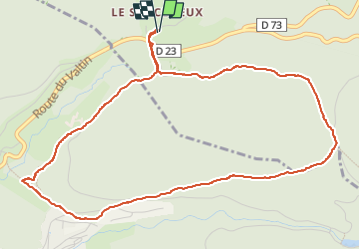

Length
5.6 km

Max alt
928 m

Uphill gradient
180 m
Km-Effort
8 km

Min alt
764 m

Downhill gradient
181 m
Boucle
Yes
Creation date :
2025-05-04 14:34:39.93
Updated on :
2025-05-04 17:02:53.811
1h15
Difficulty : Easy

FREE GPS app for hiking
 SityTrail
IGN / Geographical institutes
SityTrail Plus
The world is yours!
About
Trail Walking of 5.6 km to be discovered at Grand Est, Vosges, Ban-sur-Meurthe-Clefcy. This trail is proposed by surceneux.
Description
SURCENEUX GASPARD BROCHES AR
Positioning
Country:
France
Region :
Grand Est
Department/Province :
Vosges
Municipality :
Ban-sur-Meurthe-Clefcy
Location:
Unknown
Start:(Dec)
Start:(UTM)
347850 ; 5329045 (32U) N.
Comments