


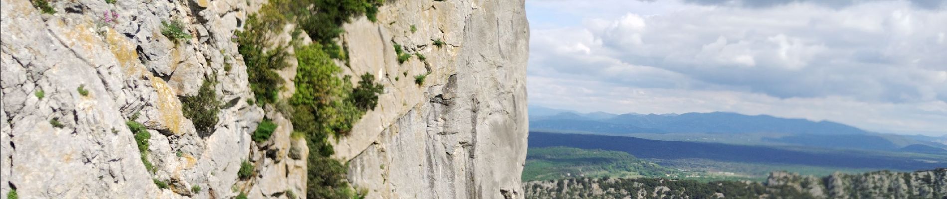
Pic St Loup

cousam
User
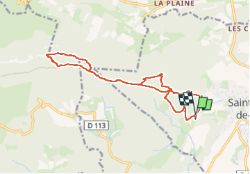

Length
9.4 km

Max alt
649 m

Uphill gradient
555 m
Km-Effort
16.8 km

Min alt
135 m

Downhill gradient
552 m
Boucle
Yes
Creation date :
2025-05-07 07:03:51.814
Updated on :
2025-05-08 08:33:14.998
5h06
Difficulty : Difficult

FREE GPS app for hiking
 SityTrail
IGN / Geographical institutes
SityTrail Plus
The world is yours!
About
Trail Walking of 9.4 km to be discovered at Occitania, Hérault, Saint-Mathieu-de-Tréviers. This trail is proposed by cousam.
Description
le passage par les crêtes assez hard nécessitant de s'aider des mains, bon balisage (point jaune)
Photos


24 photos in total. Please click on a photo to see them all in the gallery.
Positioning
Country:
France
Region :
Occitania
Department/Province :
Hérault
Municipality :
Saint-Mathieu-de-Tréviers
Location:
Unknown
Start:(Dec)
Start:(UTM)
568249 ; 4846402 (31T) N.
Comments