


dDe Tartonne à Thorame basse

laurentnerual
User
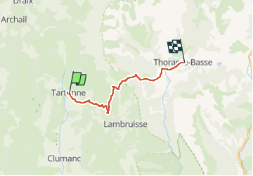

Length
15.9 km

Max alt
1388 m

Uphill gradient
665 m
Km-Effort
24 km

Min alt
927 m

Downhill gradient
491 m
Boucle
No
Creation date :
2025-05-07 07:14:11.566
Updated on :
2025-05-07 13:50:24.033
6h13
Difficulty : Very difficult

FREE GPS app for hiking
 SityTrail
IGN / Geographical institutes
SityTrail Plus
The world is yours!
About
Trail Walking of 15.9 km to be discovered at Provence-Alpes-Côte d'Azur, Alpes-de-Haute-Provence, Tartonne. This trail is proposed by laurentnerual.
Description
sous la pluies
Positioning
Country:
France
Region :
Provence-Alpes-Côte d'Azur
Department/Province :
Alpes-de-Haute-Provence
Municipality :
Tartonne
Location:
Unknown
Start:(Dec)
Start:(UTM)
290890 ; 4882798 (32T) N.
Comments