


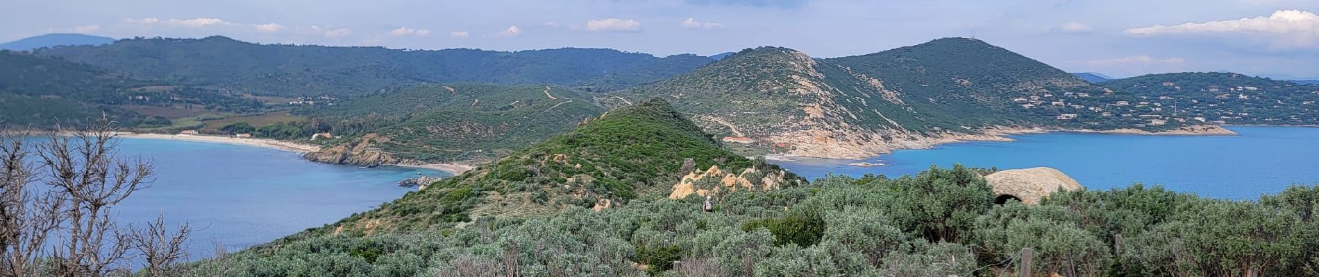
Plage de l'Escalet-Cap Taillat AR

mb83serre
User GUIDE
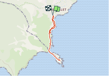

Length
5.6 km

Max alt
49 m

Uphill gradient
129 m
Km-Effort
7.3 km

Min alt
2 m

Downhill gradient
128 m
Boucle
Yes
Creation date :
2025-05-07 16:25:37.482
Updated on :
2025-05-07 16:28:36.061
1h39
Difficulty : Medium

FREE GPS app for hiking
 SityTrail
IGN / Geographical institutes
SityTrail Plus
The world is yours!
About
Trail Walking of 5.6 km to be discovered at Provence-Alpes-Côte d'Azur, Var, Ramatuelle. This trail is proposed by mb83serre.
Photos

Positioning
Country:
France
Region :
Provence-Alpes-Côte d'Azur
Department/Province :
Var
Municipality :
Ramatuelle
Location:
Unknown
Start:(Dec)
Start:(UTM)
308335 ; 4784342 (32T) N.
Comments