


Trace rougemont_baerenkopf-21297252-1746543635-29

chantalwaltzer
User
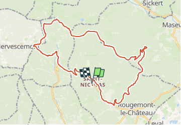

Length
22 km

Max alt
1070 m

Uphill gradient
869 m
Km-Effort
33 km

Min alt
471 m

Downhill gradient
871 m
Boucle
Yes
Creation date :
2025-05-07 18:36:08.0
Updated on :
2025-05-07 18:36:11.22

FREE GPS app for hiking
 SityTrail
IGN / Geographical institutes
SityTrail Plus
The world is yours!
About
Trail of 22 km to be discovered at Bourgogne-Franche-Comté, Territoire-de-Belfort, Rougemont-le-Château. This trail is proposed by chantalwaltzer.
Positioning
Country:
France
Region :
Bourgogne-Franche-Comté
Department/Province :
Territoire-de-Belfort
Municipality :
Rougemont-le-Château
Location:
Unknown
Start:(Dec)
Start:(UTM)
345423 ; 5290307 (32T) N.
Comments