


pont d'arc AR

jpaul77
User

Length
10.8 km

Max alt
301 m

Uphill gradient
424 m
Km-Effort
16.5 km

Min alt
85 m

Downhill gradient
429 m
Boucle
No
Creation date :
2025-05-08 07:41:11.067
Updated on :
2025-05-08 13:51:34.936
6h09
Difficulty : Difficult

FREE GPS app for hiking
 SityTrail
IGN / Geographical institutes
SityTrail Plus
The world is yours!
About
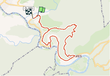
Trail Walking of 10.8 km to be discovered at Auvergne-Rhône-Alpes, Ardèche, Vallon-Pont-d'Arc. This trail is proposed by jpaul77.
Description
difficulté en cas de pluie, belles vues sur le pont et les alentours, parcours exigeant
Positioning
Country:
France
Region :
Auvergne-Rhône-Alpes
Department/Province :
Ardèche
Municipality :
Vallon-Pont-d'Arc
Location:
Unknown
Start:(Dec)
Start:(UTM)
612030 ; 4916611 (31T) N.
Comments