


Vaugne

Poupette Dumay
User

Length
34 km

Max alt
685 m

Uphill gradient
860 m
Km-Effort
46 km

Min alt
266 m

Downhill gradient
974 m
Boucle
No
Creation date :
2025-05-08 12:04:28.479
Updated on :
2025-05-08 16:45:16.659
4h39
Difficulty : Difficult

FREE GPS app for hiking
 SityTrail
IGN / Geographical institutes
SityTrail Plus
The world is yours!
About
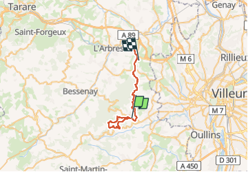
Trail Walking of 34 km to be discovered at Auvergne-Rhône-Alpes, Rhône, Vaugneray. This trail is proposed by Poupette Dumay .
Description
Vaugneray
Positioning
Country:
France
Region :
Auvergne-Rhône-Alpes
Department/Province :
Rhône
Municipality :
Vaugneray
Location:
Vaugneray
Start:(Dec)
Start:(UTM)
628950 ; 5066339 (31T) N.
Comments