


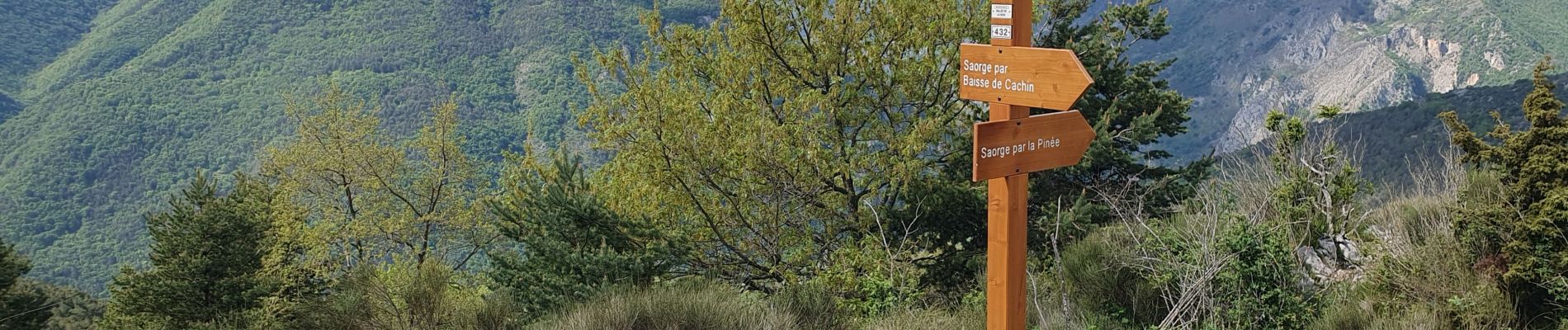
saorge col peiremont crête peiremont

Christine Cadas
User
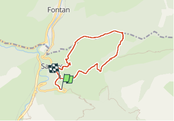

Length
8.5 km

Max alt
1036 m

Uphill gradient
627 m
Km-Effort
16.5 km

Min alt
457 m

Downhill gradient
537 m
Boucle
No
Creation date :
2025-05-07 06:46:31.517
Updated on :
2025-05-17 18:32:37.87
3h45
Difficulty : Difficult

FREE GPS app for hiking
 SityTrail
IGN / Geographical institutes
SityTrail Plus
The world is yours!
About
Trail Walking of 8.5 km to be discovered at Provence-Alpes-Côte d'Azur, Maritime Alps, Saorge. This trail is proposed by Christine Cadas.
Description
jolie boucle de 7.3km 560m deniv
Photos


Positioning
Country:
France
Region :
Provence-Alpes-Côte d'Azur
Department/Province :
Maritime Alps
Municipality :
Saorge
Location:
Unknown
Start:(Dec)
Start:(UTM)
384124 ; 4870918 (32T) N.
Comments