


Ault parle bois de Cise

Lecoester
User
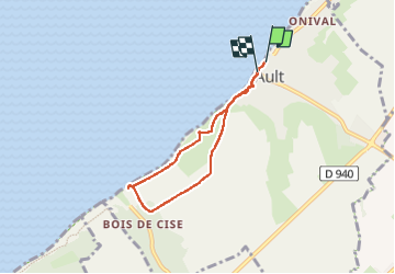

Length
5.1 km

Max alt
82 m

Uphill gradient
118 m
Km-Effort
6.7 km

Min alt
14 m

Downhill gradient
127 m
Boucle
Yes
Creation date :
2024-05-09 13:16:22.166
Updated on :
2025-05-09 13:44:50.333
1h32
Difficulty : Medium

FREE GPS app for hiking
 SityTrail
IGN / Geographical institutes
SityTrail Plus
The world is yours!
About
Trail Walking of 5.1 km to be discovered at Hauts-de-France, Somme, Ault. This trail is proposed by Lecoester.
Description
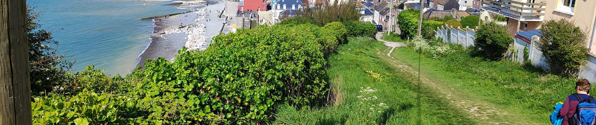
Belle petite Randonnée avec de superbes vues
Photos


Positioning
Country:
France
Region :
Hauts-de-France
Department/Province :
Somme
Municipality :
Ault
Location:
Unknown
Start:(Dec)
Start:(UTM)
388929 ; 5551233 (31U) N.
Comments