


rando argain

fousik
User

Length
8.3 km

Max alt
501 m

Uphill gradient
286 m
Km-Effort
12 km

Min alt
344 m

Downhill gradient
252 m
Boucle
No
Creation date :
2025-05-10 07:10:59.265
Updated on :
2025-05-10 09:53:32.529
2h01
Difficulty : Medium

FREE GPS app for hiking
 SityTrail
IGN / Geographical institutes
SityTrail Plus
The world is yours!
About
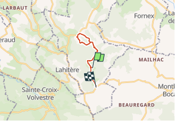
Trail Walking of 8.3 km to be discovered at Occitania, Haute-Garonne, Montesquieu-Volvestre. This trail is proposed by fousik.
Positioning
Country:
France
Region :
Occitania
Department/Province :
Haute-Garonne
Municipality :
Montesquieu-Volvestre
Location:
Unknown
Start:(Dec)
Start:(UTM)
354492 ; 4777882 (31T) N.
Comments