


Baie de Somme (1) 2025

raymondvanroosbroeck
User
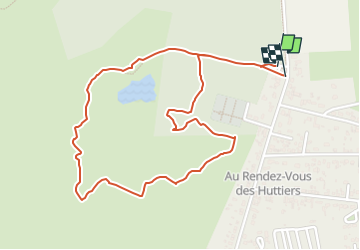

Length
2.5 km

Max alt
10 m

Uphill gradient
4 m
Km-Effort
2.6 km

Min alt
6 m

Downhill gradient
4 m
Boucle
Yes
Creation date :
2025-05-11 08:49:18.036
Updated on :
2025-05-14 08:02:59.928
34m
Difficulty : Easy

FREE GPS app for hiking
 SityTrail
IGN / Geographical institutes
SityTrail Plus
The world is yours!
About
Trail Walking of 2.5 km to be discovered at Hauts-de-France, Somme, Fort-Mahon-Plage. This trail is proposed by raymondvanroosbroeck.
Positioning
Country:
France
Region :
Hauts-de-France
Department/Province :
Somme
Municipality :
Fort-Mahon-Plage
Location:
Unknown
Start:(Dec)
Start:(UTM)
398358 ; 5578806 (31U) N.
Comments