


Montchafrey madeleine

rolland-a
User

Length
13.4 km

Max alt
1408 m

Uphill gradient
518 m
Km-Effort
20 km

Min alt
888 m

Downhill gradient
583 m
Boucle
No
Creation date :
2025-05-06 06:46:10.0
Updated on :
2025-05-11 21:28:03.322
4h05
Difficulty : Very difficult

FREE GPS app for hiking
 SityTrail
IGN / Geographical institutes
SityTrail Plus
The world is yours!
About
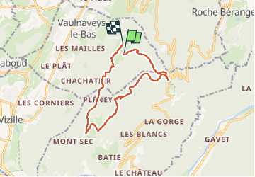
Trail Walking of 13.4 km to be discovered at Auvergne-Rhône-Alpes, Isère, Vaulnaveys-le-Bas. This trail is proposed by rolland-a.
Positioning
Country:
France
Region :
Auvergne-Rhône-Alpes
Department/Province :
Isère
Municipality :
Vaulnaveys-le-Bas
Location:
Unknown
Start:(Dec)
Start:(UTM)
722431 ; 4997801 (31T) N.
Comments