


Grotte de la Susterragne

ARVIEU
User
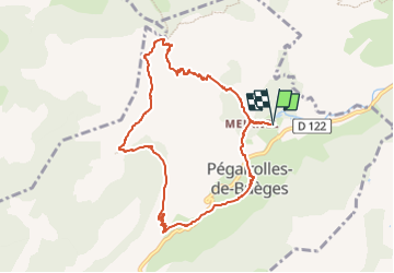

Length
9.5 km

Max alt
700 m

Uphill gradient
576 m
Km-Effort
17.1 km

Min alt
172 m

Downhill gradient
577 m
Boucle
Yes
Creation date :
2025-05-13 07:01:01.031
Updated on :
2025-05-13 07:04:32.866
4h00
Difficulty : Medium

FREE GPS app for hiking
 SityTrail
IGN / Geographical institutes
SityTrail Plus
The world is yours!
About
Trail Walking of 9.5 km to be discovered at Occitania, Hérault, Pégairolles-de-Buèges. This trail is proposed by ARVIEU.
Description
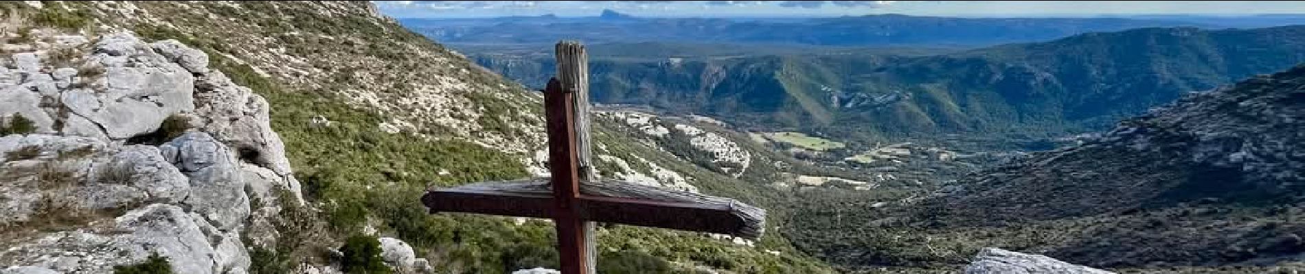
Départ du parking du Méjanel, grotte de la Susterragne, retour sur le plateau par le GR 73, descente au Méjanel par le PR sous le cirque de Peyre Martine.
Photos


Positioning
Country:
France
Region :
Occitania
Department/Province :
Hérault
Municipality :
Pégairolles-de-Buèges
Location:
Unknown
Start:(Dec)
Start:(UTM)
547531 ; 4851223 (31T) N.
Comments