


Gr 46 Rocamadour La Bastide Murat

taguette
User
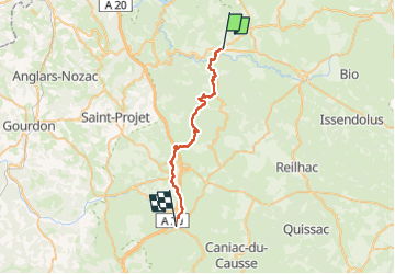

Length
28 km

Max alt
448 m

Uphill gradient
855 m
Km-Effort
39 km

Min alt
136 m

Downhill gradient
665 m
Boucle
No
Creation date :
2025-05-13 06:39:13.42
Updated on :
2025-05-13 15:20:37.723
8h38
Difficulty : Very difficult

FREE GPS app for hiking
 SityTrail
IGN / Geographical institutes
SityTrail Plus
The world is yours!
About
Trail Walking of 28 km to be discovered at Occitania, Lot, Rocamadour. This trail is proposed by taguette.
Positioning
Country:
France
Region :
Occitania
Department/Province :
Lot
Municipality :
Rocamadour
Location:
Unknown
Start:(Dec)
Start:(UTM)
391404 ; 4962339 (31T) N.
Comments