


Vassieux - Lans en Vercors

attitude73
User
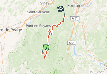

Length
65 km

Max alt
1388 m

Uphill gradient
1464 m
Km-Effort
85 km

Min alt
697 m

Downhill gradient
1552 m
Boucle
No
Creation date :
2025-05-14 12:25:29.428
Updated on :
2025-05-14 12:26:55.332
0m
Difficulty : Medium

FREE GPS app for hiking
 SityTrail
IGN / Geographical institutes
SityTrail Plus
The world is yours!
About
Trail Cycle of 65 km to be discovered at Auvergne-Rhône-Alpes, Drôme, Vassieux-en-Vercors. This trail is proposed by attitude73.
Positioning
Country:
France
Region :
Auvergne-Rhône-Alpes
Department/Province :
Drôme
Municipality :
Vassieux-en-Vercors
Location:
Unknown
Start:(Dec)
Start:(UTM)
687886 ; 4971824 (31T) N.
Comments