


Vassieux - Villard de Lans

attitude73
User
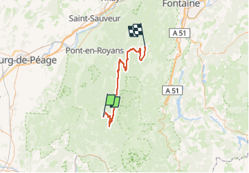

Length
60 km

Max alt
1388 m

Uphill gradient
1361 m
Km-Effort
79 km

Min alt
688 m

Downhill gradient
1507 m
Boucle
No
Creation date :
2025-05-14 12:37:54.278
Updated on :
2025-05-14 15:47:45.795
0m
Difficulty : Medium

FREE GPS app for hiking
 SityTrail
IGN / Geographical institutes
SityTrail Plus
The world is yours!
About
Trail Cycle of 60 km to be discovered at Auvergne-Rhône-Alpes, Drôme, Vassieux-en-Vercors. This trail is proposed by attitude73.
Positioning
Country:
France
Region :
Auvergne-Rhône-Alpes
Department/Province :
Drôme
Municipality :
Vassieux-en-Vercors
Location:
Unknown
Start:(Dec)
Start:(UTM)
687899 ; 4971831 (31T) N.
Comments