


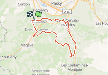
Combloux st nicolas

veroarvinberod
User

Length
34 km

Max alt
1483 m

Uphill gradient
1328 m
Km-Effort
51 km

Min alt
707 m

Downhill gradient
1338 m
Boucle
Yes
Creation date :
2025-05-16 07:52:57.064
Updated on :
2025-05-16 07:53:45.988
3h33
Difficulty : Very difficult

FREE GPS app for hiking
 SityTrail
IGN / Geographical institutes
SityTrail Plus
The world is yours!
About
Trail Mountain bike of 34 km to be discovered at Auvergne-Rhône-Alpes, Upper Savoy, Combloux. This trail is proposed by veroarvinberod.
Positioning
Country:
France
Region :
Auvergne-Rhône-Alpes
Department/Province :
Upper Savoy
Municipality :
Combloux
Location:
Unknown
Start:(Dec)
Start:(UTM)
316520 ; 5085141 (32T) N.
Comments