


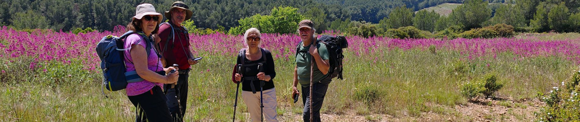
St Cyr la montagne de sable

bernir
User
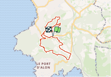

Length
9.5 km

Max alt
213 m

Uphill gradient
311 m
Km-Effort
13.6 km

Min alt
30 m

Downhill gradient
311 m
Boucle
Yes
Creation date :
2025-05-15 07:30:14.53
Updated on :
2025-05-16 08:51:20.873
3h05
Difficulty : Easy

FREE GPS app for hiking
 SityTrail
IGN / Geographical institutes
SityTrail Plus
The world is yours!
About
Trail Walking of 9.5 km to be discovered at Provence-Alpes-Côte d'Azur, Var, Saint-Cyr-sur-Mer. This trail is proposed by bernir.
Photos


Positioning
Country:
France
Region :
Provence-Alpes-Côte d'Azur
Department/Province :
Var
Municipality :
Saint-Cyr-sur-Mer
Location:
Unknown
Start:(Dec)
Start:(UTM)
719864 ; 4782209 (31T) N.
Comments