


TourBourgChateldon1

JackPG
User

Length
7.3 km

Max alt
405 m

Uphill gradient
219 m
Km-Effort
10.2 km

Min alt
297 m

Downhill gradient
219 m
Boucle
Yes
Creation date :
2015-07-16 00:00:00.0
Updated on :
2015-07-16 00:00:00.0
2h14
Difficulty : Medium

FREE GPS app for hiking
 SityTrail
IGN / Geographical institutes
SityTrail Plus
The world is yours!
About
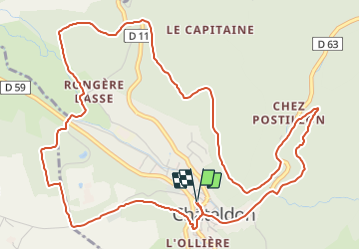
Trail Walking of 7.3 km to be discovered at Auvergne-Rhône-Alpes, Puy-de-Dôme, Châteldon. This trail is proposed by JackPG.

Positioning
Country:
France
Region :
Auvergne-Rhône-Alpes
Department/Province :
Puy-de-Dôme
Municipality :
Châteldon
Location:
Unknown
Start:(Dec)
Start:(UTM)
540228 ; 5091692 (31T) N.
Comments