


8- Batsi - Gavrio

v.hanosset
User
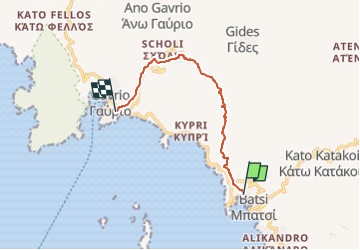

Length
9 km

Max alt
361 m

Uphill gradient
423 m
Km-Effort
14.6 km

Min alt
6 m

Downhill gradient
415 m
Boucle
No
Creation date :
2025-05-18 13:54:12.878
Updated on :
2025-05-18 13:54:39.87
3h19
Difficulty : Difficult

FREE GPS app for hiking
 SityTrail
IGN / Geographical institutes
SityTrail Plus
The world is yours!
About
Trail Walking of 9 km to be discovered at Aegean, Andros Regional Unit. This trail is proposed by v.hanosset.
Positioning
Country:
Greece
Region :
Aegean
Department/Province :
Andros Regional Unit
Municipality :
Unknown
Location:
Unknown
Start:(Dec)
Start:(UTM)
305006 ; 4192558 (35S) N.
Comments