


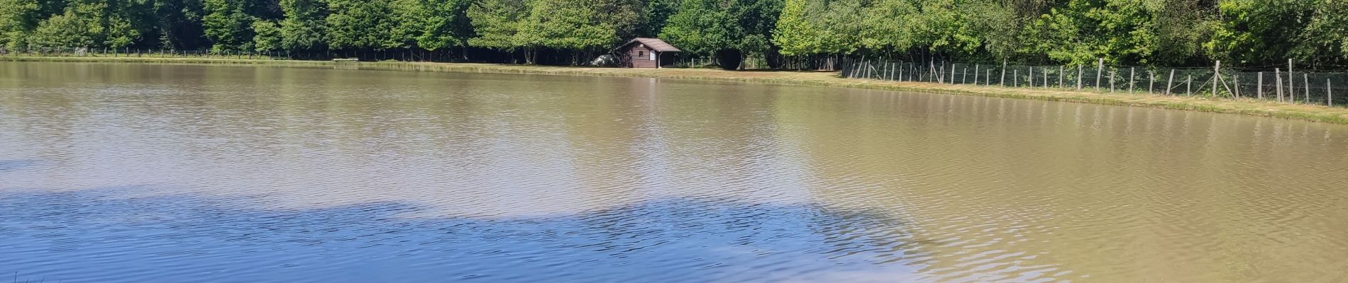
Les etangs

jeanlucm88
User
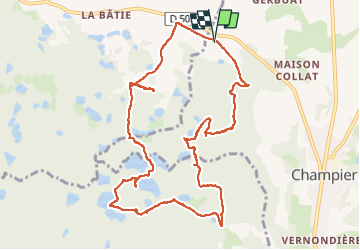

Length
11.9 km

Max alt
616 m

Uphill gradient
192 m
Km-Effort
14.5 km

Min alt
549 m

Downhill gradient
195 m
Boucle
Yes
Creation date :
2025-05-18 11:39:46.807
Updated on :
2025-05-18 15:19:31.331
3h10
Difficulty : Difficult

FREE GPS app for hiking
 SityTrail
IGN / Geographical institutes
SityTrail Plus
The world is yours!
About
Trail Walking of 11.9 km to be discovered at Auvergne-Rhône-Alpes, Isère, Champier. This trail is proposed by jeanlucm88.
Photos


Positioning
Country:
France
Region :
Auvergne-Rhône-Alpes
Department/Province :
Isère
Municipality :
Champier
Location:
Unknown
Start:(Dec)
Start:(UTM)
677622 ; 5037841 (31T) N.
Comments