


Le trayas pic de l’ours et d’aurele

Gilles Auffret
User
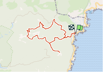

Length
10.5 km

Max alt
480 m

Uphill gradient
520 m
Km-Effort
17.4 km

Min alt
12 m

Downhill gradient
519 m
Boucle
Yes
Creation date :
2025-05-15 06:40:52.0
Updated on :
2025-05-20 11:51:10.894
3h16
Difficulty : Difficult

FREE GPS app for hiking
 SityTrail
IGN / Geographical institutes
SityTrail Plus
The world is yours!
About
Trail Walking of 10.5 km to be discovered at Provence-Alpes-Côte d'Azur, Var, Saint-Raphaël. This trail is proposed by Gilles Auffret.
Positioning
Country:
France
Region :
Provence-Alpes-Côte d'Azur
Department/Province :
Var
Municipality :
Saint-Raphaël
Location:
Unknown
Start:(Dec)
Start:(UTM)
332144 ; 4815552 (32T) N.
Comments