


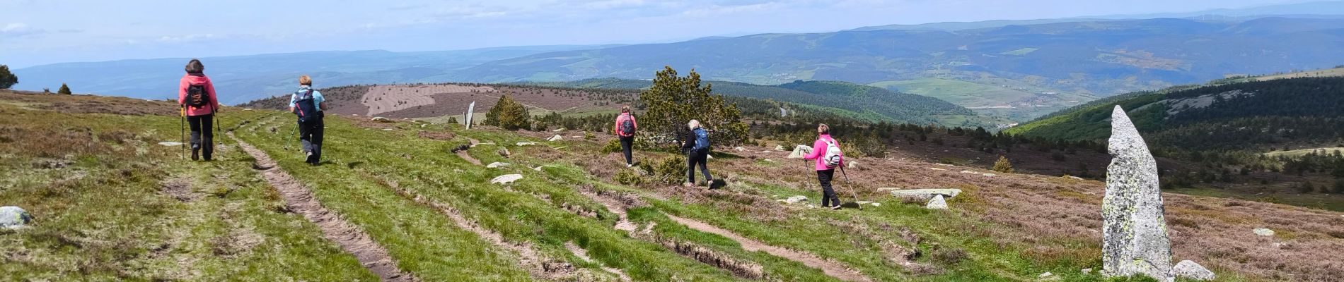
Mont Lozère/ Sommet de Finiels

tyntyn
User
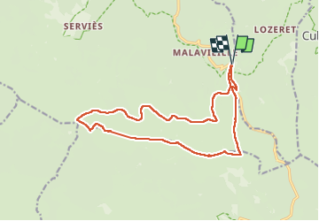

Length
16.7 km

Max alt
1699 m

Uphill gradient
384 m
Km-Effort
22 km

Min alt
1411 m

Downhill gradient
384 m
Boucle
Yes
Creation date :
2025-05-21 07:49:56.687
Updated on :
2025-05-21 13:45:07.055
5h07
Difficulty : Medium

FREE GPS app for hiking
 SityTrail
IGN / Geographical institutes
SityTrail Plus
The world is yours!
About
Trail Walking of 16.7 km to be discovered at Occitania, Lozère, Cubières. This trail is proposed by tyntyn.
Photos


Positioning
Country:
France
Region :
Occitania
Department/Province :
Lozère
Municipality :
Cubières
Location:
Unknown
Start:(Dec)
Start:(UTM)
559525 ; 4922334 (31T) N.
Comments