


Trace M2 Commandeur Guy 210525

mitch1952
User
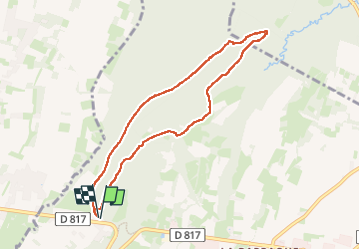

Length
8.3 km

Max alt
407 m

Uphill gradient
122 m
Km-Effort
10 km

Min alt
308 m

Downhill gradient
122 m
Boucle
Yes
Creation date :
2025-05-21 11:42:31.0
Updated on :
2025-05-21 14:14:15.441

FREE GPS app for hiking
 SityTrail
IGN / Geographical institutes
SityTrail Plus
The world is yours!
About
Trail of 8.3 km to be discovered at Occitania, Hautespyrenees, Ibos. This trail is proposed by mitch1952.
Positioning
Country:
France
Region :
Occitania
Department/Province :
Hautespyrenees
Municipality :
Ibos
Location:
Unknown
Start:(Dec)
Start:(UTM)
741585 ; 4792360 (30T) N.
Comments