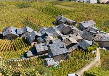
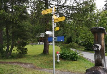
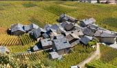
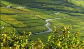
Trail Walking Saint-Léonard - Chemin du Vignoble - Photo

Randonnées de la Maison du tourisme de Crans-Montana GUIDE+

© OpenStreetMap contributors
Length
Length
25 km
Max alt
Max alt
841 m
Uphill gradient
Uphill gradient
981 m
Km-Effort
Km-Effort  
37 km
Min alt
Min alt
500 m
Downhill gradient
Downhill gradient
750 m
Boucle
Boucle
No
Creation date :
2014-12-10 00:00:00.0
Updated on :
2014-12-10 00:00:00.0

(0 Reviews)

Walking
Walking
9h00
Difficulty : Unknown

Scan this QR Code to open this trail in the SityTrail application

FREE GPS app for hiking

Logo SityTrail SityTrail
IGN / Geographical institutes

Download SityTrail from the App Store Download SityTrail from Google Play

Logo SityTrail SityTrail World
The world is yours!

Download SityTrail from the App Store Download SityTrail from Google Play Download SityTrail on Huawei AppGallery

About

Trail Walking of 25 km to be discovered at Valais/Wallis, Sierre, Saint-Léonard. This trail is proposed by Maison du Tourisme Crans-Montana.

Description

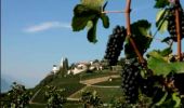
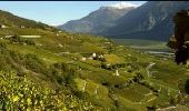
Le chemin du vignoble, c’est environ 25 km répartis entre Saint Léonard et la gare de Loèche-Susten que tout au long du parcours vous pourrez situer en dessous des paraboles de la station terrienne de communication satellite que vous apercevez sur les hauts de Loèche. Ce tracé évoluant entre 500 et 800 m d’altitude est particulièrement adapté à une découverte en plusieurs étapes. En effet sur son tracé, vous croiserez des lignes de transport publics. Le moment idéal dans l’année pour découvrir le vignoble, c’est évidemment les mois d’août septembre alors que les raisins arrivent à maturité sur les ceps vigoureux des coteaux de Flanthey, Corin, Venthône, Salquenen et Varone. Ces parchets de vignes sont travaillés par des vignerons minutieux qui font que la terre, l’eau, l’air et le soleil de notre région se retrouvent sur les meilleures tables, jusqu’au confins du continent et même d’outre mer.

Elevation profile

Photos

Points of interest

Point of interest Saint-Léonard - St- Léonard - Photo
Maison du Tourisme Crans-Montana
SAINT-LÉONARD 
Point of interest Crans-Montana - Petit Ollon - Photo
Maison du Tourisme Crans-Montana
CRANS-MONTANA 
Point of interest Crans-Montana - Corin - Photo
Maison du Tourisme Crans-Montana
CRANS-MONTANA 
Point of interest Crans-Montana - Loc - Photo
Maison du Tourisme Crans-Montana
CRANS-MONTANA 
Point of interest Varen - Varen - Photo
Maison du Tourisme Crans-Montana
VAREN 
Point of interest Salgesch - poi_184142 - Photo
Maison du Tourisme Crans-Montana
SALGESCH 
Point of interest Leuk - poi_2396492 - Photo
Maison du Tourisme Crans-Montana

Positioning

Country:
Switzerland
Region :
Valais/Wallis
Department/Province :
Sierre
Municipality :
Saint-Léonard
Location:
Unknown
Start:(UTM)
377944 ; 5123556 (32T) N.

Trails nearby

Trail Walking Crans-Montana - Chemin du Vignoble - Itinéraire dégustation - Photo
Walking
GUIDE+

Walking

Very easy
Crans-Montana, Valais/Wallis, Sierre, Switzerland
7 km | 10.2 km-effort
2h 45min
No
Trail Walking Icogne - Bisse du Sillonin - Photo
Walking
GUIDE+

Walking

Very easy
Icogne, Valais/Wallis, Sierre, Switzerland
7.1 km | 9.7 km-effort
2h 15min
No
Trail Walking Sion -  - Photo
Walking
npannatier

Walking

Very easy
(1)
Sion, Valais/Wallis, Sion, Switzerland
7.4 km | 9.6 km-effort
Unknown
No
Trail Walking Savièse - Mayen de la Zour-Prabé - Photo
Walking
lroux

Walking

Very easy
(1)
Savièse, Valais/Wallis, Sion, Switzerland
3.8 km | 10.3 km-effort
Unknown
No
Trail Walking Ayent - Au pied du Wildhorn  - Photo
Walking
pjamin

Walking

Very difficult
(1)
Ayent, Valais/Wallis, Hérens, Switzerland
33 km | 64 km-effort
15h 30min
No
Trail Nordic walking Arbaz - Grimisuat  - Photo
Nordic walking
suzanne.bron

Nordic walking

Very easy
Arbaz, Valais/Wallis, Sion, Switzerland
3.6 km | 4.8 km-effort
1h 1min
No
Trail Nordic walking Ayent - 07.08.20 Tour des Alpages  - Photo
Nordic walking
suzanne.bron

Nordic walking

Very easy
Ayent, Valais/Wallis, Hérens, Switzerland
16.9 km | 25 km-effort
5h 39min
Yes
Trail Nordic walking Arbaz - 27.07.20 Pas de Maimbré  - Photo
Nordic walking
suzanne.bron

Nordic walking

Very easy
Arbaz, Valais/Wallis, Sion, Switzerland
8.4 km | 19.2 km-effort
3h 50min
No
Trail Nordic walking Arbaz - 23.07.20 Anzère  - Photo
Nordic walking
suzanne.bron

Nordic walking

Very easy
Arbaz, Valais/Wallis, Sion, Switzerland
5.9 km | 9 km-effort
1h 48min
No


Close
My subscriptions