


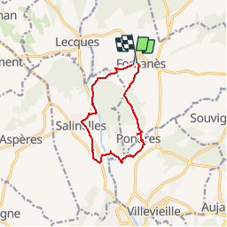

8.2 km | 10.9 km-effort


User


FREE GPS app for hiking
 SityTrail
IGN / Geographical institutes
SityTrail World
The world is yours!
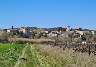
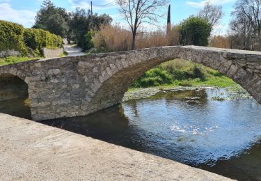
Trail Walking of 10.7 km to be discovered at Occitania, Gard, Fontanès. This trail is proposed by jeff66.
FONTANÉS 30 - La Maurine - bois du roi - La Clotte - château la Clotte-Fontane - passage sous la voie ferrée désaffectée - passage à gué sur le vidourle - moulin de Runet - cimetière - SALINELLES - le Bousquillon - les Vigners - route de Lesques - le pré de la fontaine - route de sommieres - Meynier - Valat de Romanes - passage sous D35 puis chemin le long de la D39 - chemin de la gare - moulin de Pattes - passage sur voie ferrée désaffectée - l'aigalade - terrain moto cross SOMIERES circuit de la Tourille - longer ruisseau de l'aigalade - château de PONDRES - PONDRES - place du puits - chemin de la plaine des jas - Puech des fourches - grand et petit Gardayres - les Poujades - FONTANÉS - rue du Micocoulier - rue traversiere - rue de l'église - place du temple


Walking
Walking
Walking

Walking


Walking
Walking
Walking