


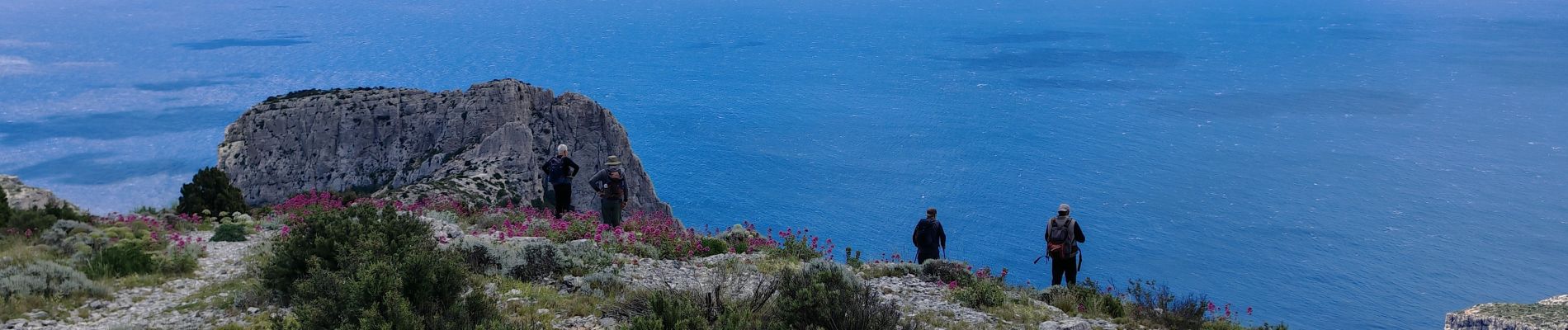
mont Puget, Grande Candelle

bernir
User

Length
14.3 km

Max alt
554 m

Uphill gradient
620 m
Km-Effort
23 km

Min alt
257 m

Downhill gradient
616 m
Boucle
Yes
Creation date :
2025-05-22 07:18:14.173
Updated on :
2025-05-23 09:09:59.66
6h39
Difficulty : Difficult

FREE GPS app for hiking
 SityTrail
IGN / Geographical institutes
SityTrail Plus
The world is yours!
About
Trail Walking of 14.3 km to be discovered at Provence-Alpes-Côte d'Azur, Bouches-du-Rhône, Marseille. This trail is proposed by bernir.
Photos


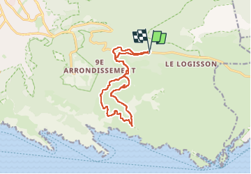
Positioning
Country:
France
Region :
Provence-Alpes-Côte d'Azur
Department/Province :
Bouches-du-Rhône
Municipality :
Marseille
Location:
9th Arrondissement
Start:(Dec)
Start:(UTM)
700925 ; 4790313 (31T) N.
Comments