


balisage grp tour du vercors font d urle col de la mure

pitzalis
User
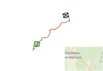

Length
5.7 km

Max alt
1473 m

Uphill gradient
173 m
Km-Effort
8.1 km

Min alt
1390 m

Downhill gradient
187 m
Boucle
No
Creation date :
2025-05-23 11:33:59.757
Updated on :
2025-05-23 11:33:59.757
1h50
Difficulty : Medium

FREE GPS app for hiking
 SityTrail
IGN / Geographical institutes
SityTrail Plus
The world is yours!
About
Trail Walking of 5.7 km to be discovered at Auvergne-Rhône-Alpes, Drôme, Bouvante. This trail is proposed by pitzalis.
Positioning
Country:
France
Region :
Auvergne-Rhône-Alpes
Department/Province :
Drôme
Municipality :
Bouvante
Location:
Unknown
Start:(Dec)
Start:(UTM)
683403 ; 4974405 (31T) N.
Comments