


Trescloux le Suillet

Roger Philippe Wallez
User GUIDE
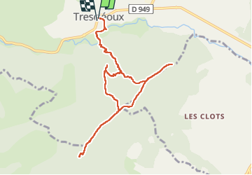

Length
10.8 km

Max alt
1314 m

Uphill gradient
841 m
Km-Effort
22 km

Min alt
655 m

Downhill gradient
838 m
Boucle
Yes
Creation date :
2025-05-24 07:26:44.0
Updated on :
2025-05-24 13:29:30.977
6h01
Difficulty : Very difficult

FREE GPS app for hiking
 SityTrail
IGN / Geographical institutes
SityTrail Plus
The world is yours!
About
Trail Walking of 10.8 km to be discovered at Provence-Alpes-Côte d'Azur, Hautes-Alpes, Trescléoux. This trail is proposed by Roger Philippe Wallez.
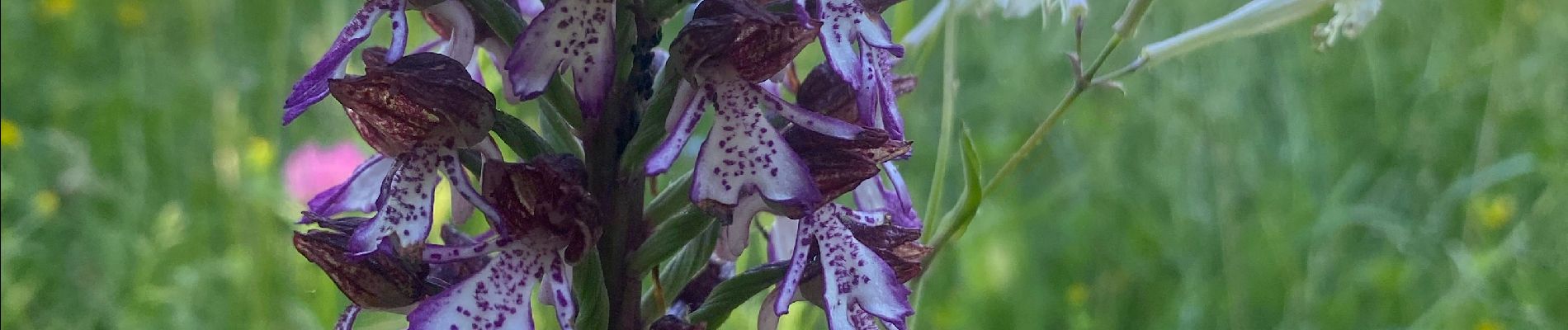
Photos


Positioning
Country:
France
Region :
Provence-Alpes-Côte d'Azur
Department/Province :
Hautes-Alpes
Municipality :
Trescléoux
Location:
Unknown
Start:(Dec)
Start:(UTM)
715880 ; 4914793 (31T) N.
Comments