


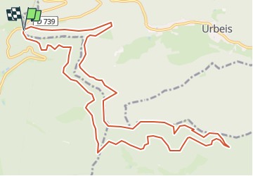
Col d'Urbeis

GR5 2020
User

Length
13.8 km

Max alt
859 m

Uphill gradient
528 m
Km-Effort
21 km

Min alt
595 m

Downhill gradient
535 m
Boucle
Yes
Creation date :
2025-05-24 14:20:34.336
Updated on :
2025-05-24 14:21:53.162
4h44
Difficulty : Medium

FREE GPS app for hiking
 SityTrail
IGN / Geographical institutes
SityTrail Plus
The world is yours!
About
Trail On foot of 13.8 km to be discovered at Grand Est, Bas-Rhin, Urbeis. This trail is proposed by GR5 2020.
Description
Col d'Urbeis, Col de la Hingrie, Col de Schlingoutte
Positioning
Country:
France
Region :
Grand Est
Department/Province :
Bas-Rhin
Municipality :
Urbeis
Location:
Unknown
Start:(Dec)
Start:(UTM)
364915 ; 5354136 (32U) N.
Comments