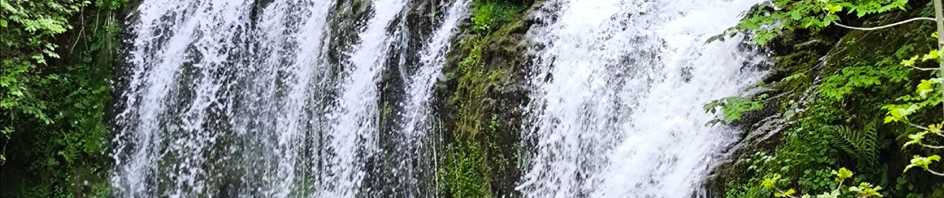
Cascades . Albepierre / Col de Prat de Bouc

tyntyn
User
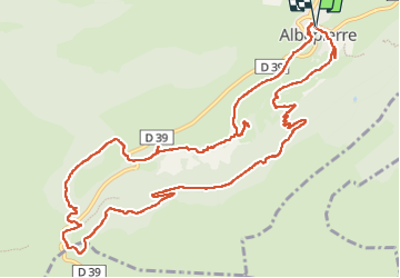

Length
14.6 km

Max alt
1423 m

Uphill gradient
458 m
Km-Effort
21 km

Min alt
1032 m

Downhill gradient
459 m
Boucle
Yes
Creation date :
2025-05-24 08:34:14.413
Updated on :
2025-05-24 14:55:18.046
5h54
Difficulty : Medium

FREE GPS app for hiking
 SityTrail
IGN / Geographical institutes
SityTrail Plus
The world is yours!
About
Trail Walking of 14.6 km to be discovered at Auvergne-Rhône-Alpes, Cantal, Albepierre-Bredons. This trail is proposed by tyntyn.
Photos


Positioning
Country:
France
Region :
Auvergne-Rhône-Alpes
Department/Province :
Cantal
Municipality :
Albepierre-Bredons
Location:
Unknown
Start:(Dec)
Start:(UTM)
486870 ; 4991539 (31T) N.
Comments