


sept orme a. meteren

le.noceur
User
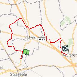

Length
12.6 km

Max alt
70 m

Uphill gradient
109 m
Km-Effort
14 km

Min alt
26 m

Downhill gradient
111 m
Boucle
No
Creation date :
2014-12-10 00:00:00.0
Updated on :
2014-12-10 00:00:00.0
--
Difficulty : Unknown

FREE GPS app for hiking
 SityTrail
IGN / Geographical institutes
SityTrail Plus
The world is yours!
About
Trail Walking of 12.6 km to be discovered at Hauts-de-France, Nord, Flêtre. This trail is proposed by le.noceur.
Positioning
Country:
France
Region :
Hauts-de-France
Department/Province :
Nord
Municipality :
Flêtre
Location:
Unknown
Start:(Dec)
Start:(UTM)
474334 ; 5620778 (31U) N.
Comments