


LOCMALO_01_CHAPELLE-ST-EUGENE_MOULIN-TESCAT_20150719

patrickdanilo
User
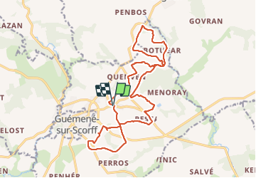

Length
19.1 km

Max alt
216 m

Uphill gradient
300 m
Km-Effort
23 km

Min alt
133 m

Downhill gradient
299 m
Boucle
Yes
Creation date :
2019-02-15 13:07:21.713
Updated on :
2025-07-28 12:02:38.668
4h34
Difficulty : Easy

FREE GPS app for hiking
 SityTrail
IGN / Geographical institutes
SityTrail Plus
The world is yours!
About
Trail Walking of 19.1 km to be discovered at Brittany, Morbihan, Locmalo. This trail is proposed by patrickdanilo.
Description
Type: Circuit-56-Morbihan
Départ: Place de L'Eglise
Photos


Positioning
Country:
France
Region :
Brittany
Department/Province :
Morbihan
Municipality :
Locmalo
Location:
Unknown
Start:(Dec)
Start:(UTM)
486201 ; 5324307 (30U) N.
Comments