


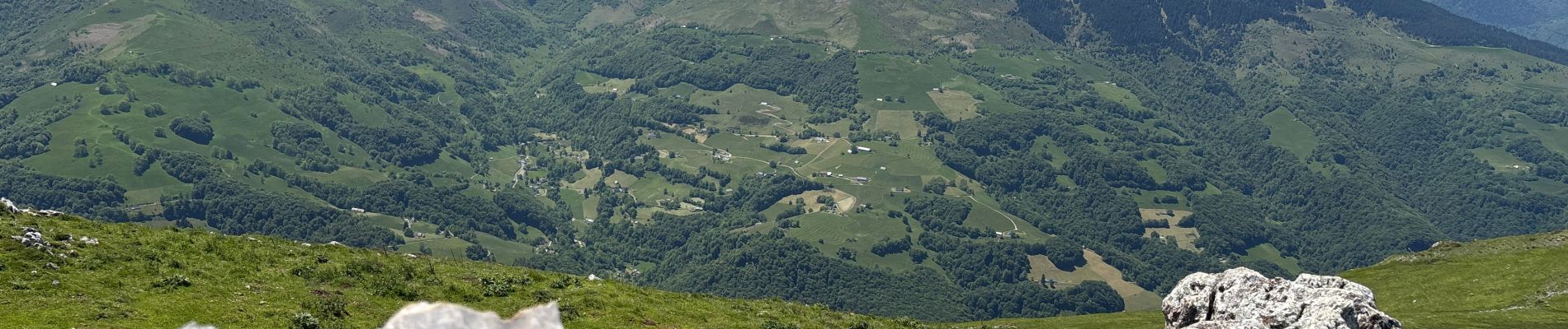
Casque du Lhéris et le Haboura

lebarça
User
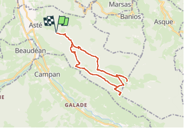

Length
16.7 km

Max alt
1619 m

Uphill gradient
1200 m
Km-Effort
33 km

Min alt
667 m

Downhill gradient
1198 m
Boucle
Yes
Creation date :
2025-05-29 07:29:20.0
Updated on :
2025-05-29 17:10:52.984
7h34
Difficulty : Difficult

FREE GPS app for hiking
 SityTrail
IGN / Geographical institutes
SityTrail Plus
The world is yours!
About
Trail Walking of 16.7 km to be discovered at Occitania, Hautespyrenees, Asté. This trail is proposed by lebarça.
Photos

Positioning
Country:
France
Region :
Occitania
Department/Province :
Hautespyrenees
Municipality :
Asté
Location:
Unknown
Start:(Dec)
Start:(UTM)
270592 ; 4768846 (31T) N.
Comments