


aucun g3 les quatre cols

LouisROGER
User GUIDE
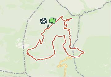

Length
12.1 km

Max alt
1555 m

Uphill gradient
540 m
Km-Effort
19.3 km

Min alt
1098 m

Downhill gradient
533 m
Boucle
Yes
Creation date :
2025-05-30 07:11:44.122
Updated on :
2025-05-30 14:52:22.815
6h56
Difficulty : Very difficult

FREE GPS app for hiking
 SityTrail
IGN / Geographical institutes
SityTrail Plus
The world is yours!
About
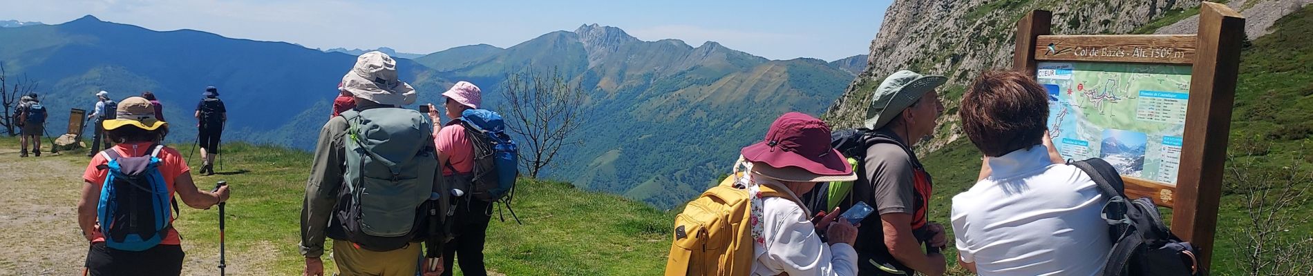
Trail Walking of 12.1 km to be discovered at Occitania, Hautespyrenees, Aucun. This trail is proposed by LouisROGER.
Photos


Positioning
Country:
France
Region :
Occitania
Department/Province :
Hautespyrenees
Municipality :
Aucun
Location:
Unknown
Start:(Dec)
Start:(UTM)
727054 ; 4764834 (30T) N.
Comments