


Chartreuse Pas de la Rousse

c.gourme
User
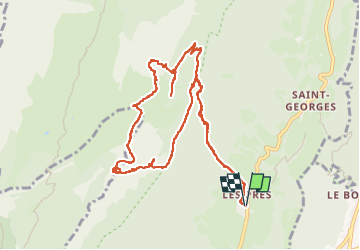

Length
12.7 km

Max alt
1826 m

Uphill gradient
1005 m
Km-Effort
26 km

Min alt
933 m

Downhill gradient
1002 m
Boucle
Yes
Creation date :
2025-06-03 07:01:55.0
Updated on :
2025-06-03 18:47:31.402
6h16
Difficulty : Difficult

FREE GPS app for hiking
 SityTrail
IGN / Geographical institutes
SityTrail Plus
The world is yours!
About
Trail Walking of 12.7 km to be discovered at Auvergne-Rhône-Alpes, Isère, Sainte-Marie-du-Mont. This trail is proposed by c.gourme.
Description
Au niveau du Pierrier, prendre à droite et suivre les marques bleues. La grotte rousse se trouve le long du chemin, pas la peine de faire des déviations

Positioning
Country:
France
Region :
Auvergne-Rhône-Alpes
Department/Province :
Isère
Municipality :
Sainte-Marie-du-Mont
Location:
Unknown
Start:(Dec)
Start:(UTM)
730548 ; 5032246 (31T) N.
Comments