


a Albert Premier 20150721

mrioux
User
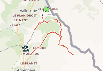

Length
18.8 km

Max alt
2710 m

Uphill gradient
1042 m
Km-Effort
35 km

Min alt
1365 m

Downhill gradient
1608 m
Boucle
No
Creation date :
2016-12-29 00:00:00.0
Updated on :
2016-12-29 00:00:00.0
6h38
Difficulty : Very difficult

FREE GPS app for hiking
 SityTrail
IGN / Geographical institutes
SityTrail Plus
The world is yours!
About
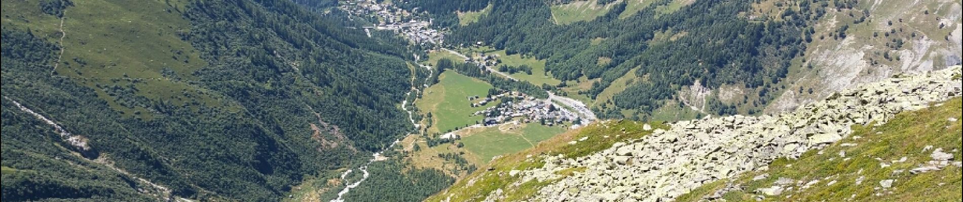
Trail Walking of 18.8 km to be discovered at Auvergne-Rhône-Alpes, Upper Savoy, Vallorcine. This trail is proposed by mrioux.
Description
départ vallorcines, puis télécabines
retour par le train
le temps inclus toutes les pauses !!!
Photos


Positioning
Country:
France
Region :
Auvergne-Rhône-Alpes
Department/Province :
Upper Savoy
Municipality :
Vallorcine
Location:
Unknown
Start:(Dec)
Start:(UTM)
341312 ; 5099394 (32T) N.
Comments