


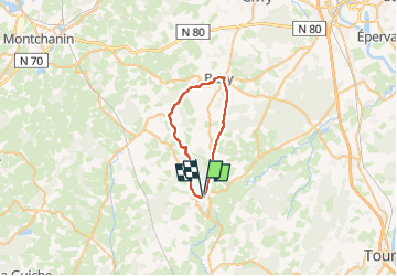
SAINT GENGOUX LE NATIONAL

JPFLOS
User

Length
30 km

Max alt
378 m

Uphill gradient
469 m
Km-Effort
36 km

Min alt
217 m

Downhill gradient
473 m
Boucle
Yes
Creation date :
2025-06-05 09:18:51.873
Updated on :
2025-06-05 09:20:03.769
0m
Difficulty : Very easy

FREE GPS app for hiking
 SityTrail
IGN / Geographical institutes
SityTrail Plus
The world is yours!
About
Trail Cycle of 30 km to be discovered at Bourgogne-Franche-Comté, Saône-et-Loire, Saint-Gengoux-le-National. This trail is proposed by JPFLOS.
Positioning
Country:
France
Region :
Bourgogne-Franche-Comté
Department/Province :
Saône-et-Loire
Municipality :
Saint-Gengoux-le-National
Location:
Unknown
Start:(Dec)
Start:(UTM)
628302 ; 5163433 (31T) N.
Comments