


Donceel

castorgris
User
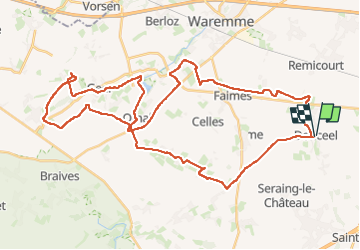

Length
45 km

Max alt
179 m

Uphill gradient
308 m
Km-Effort
49 km

Min alt
117 m

Downhill gradient
308 m
Boucle
Yes
Creation date :
2025-06-05 07:26:41.0
Updated on :
2025-06-05 10:56:46.827

FREE GPS app for hiking
 SityTrail
IGN / Geographical institutes
SityTrail Plus
The world is yours!
About
Trail of 45 km to be discovered at Wallonia, Liège, Donceel. This trail is proposed by castorgris.
Positioning
Country:
Belgium
Region :
Wallonia
Department/Province :
Liège
Municipality :
Donceel
Location:
Unknown
Start:(Dec)
Start:(UTM)
664002 ; 5613219 (31U) N.
Comments