


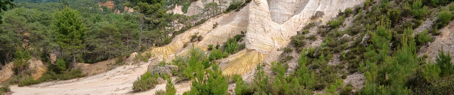
84-rustrel_colorado_provencal_4km80m

SyMA
User
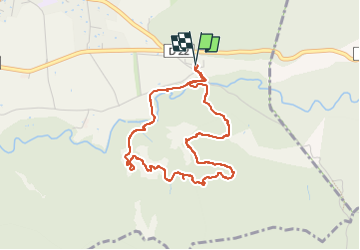

Length
4.3 km

Max alt
429 m

Uphill gradient
86 m
Km-Effort
5.4 km

Min alt
353 m

Downhill gradient
85 m
Boucle
Yes
Creation date :
2025-06-05 13:03:42.109
Updated on :
2025-06-05 15:13:39.035
2h09
Difficulty : Easy

FREE GPS app for hiking
 SityTrail
IGN / Geographical institutes
SityTrail Plus
The world is yours!
About
Trail Walking of 4.3 km to be discovered at Provence-Alpes-Côte d'Azur, Vaucluse, Rustrel. This trail is proposed by SyMA.
Photos


Positioning
Country:
France
Region :
Provence-Alpes-Côte d'Azur
Department/Province :
Vaucluse
Municipality :
Rustrel
Location:
Unknown
Start:(Dec)
Start:(UTM)
700762 ; 4865949 (31T) N.
Comments