Trail Walking Peyrus - chemin des moines (route du sel) - Photo

chemin des moines (route du sel)

 ajd26
ajd26

User

© OpenStreetMap contributors
Length
Length
23 km
Max alt
Max alt
1195 m
Uphill gradient
Uphill gradient
1201 m
Km-Effort
Km-Effort  
39 km
Min alt
Min alt
407 m
Downhill gradient
Downhill gradient
1202 m
Boucle
Boucle
Yes
Creation date :
2025-06-05 07:05:02.0
Updated on :
2025-06-06 07:14:50.588

(0 Reviews)

Walking
Walking
6h32
Difficulty : Very difficult

Scan this QR Code to open this trail in the SityTrail application

FREE GPS app for hiking

Logo SityTrail SityTrail

IGN / Geographical institutes

Download SityTrail from the App Store Download SityTrail from Google Play

Logo SityTrail SityTrail Plus

The world is yours!

Download SityTrail from the App Store Download SityTrail from Google Play Download SityTrail on Huawei AppGallery

About

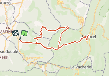
Trail Walking of 23 km to be discovered at Auvergne-Rhône-Alpes, Drôme, Peyrus. This trail is proposed by ajd26.

Description

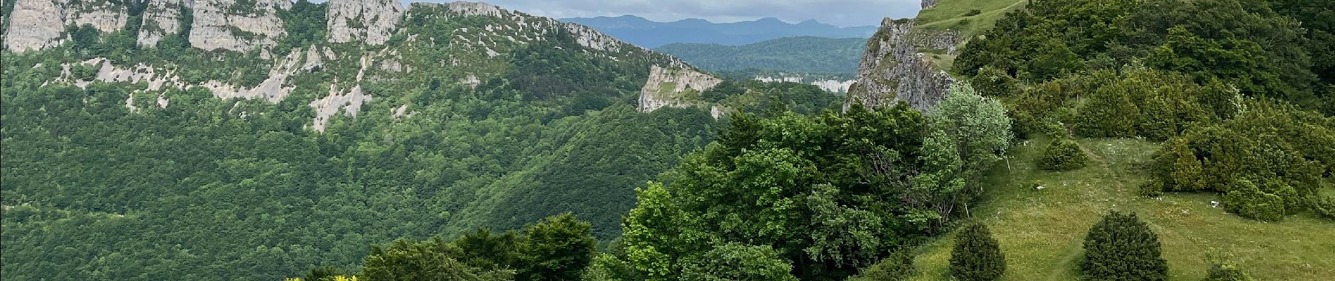
départ de Peyrus, pas du Touet, Léoncel (repas sympa à l'auberge) et retour par le pas de St Vincent
la descente depuis le pas de St Vincent est raide, longue et éprouvante
beaux panoramas depuis le pas de St Vincent
possible de monter à Pierre Chauve 100m de dénivelé supplémentaire

Elevation profile

Photos

Positioning

Country:
France
Region :
Auvergne-Rhône-Alpes
Department/Province :
Drôme
Municipality :
Peyrus
Location:
Unknown
Start:(UTM)
666892 ; 4974972 (31T) N.


Close
My subscriptions