


Sillon des anglais 22-07-2015

jmrobin
User

Length
10.8 km

Max alt
105 m

Uphill gradient
229 m
Km-Effort
13.9 km

Min alt
0 m

Downhill gradient
227 m
Boucle
Yes
Creation date :
2019-03-04 10:38:05.11
Updated on :
2019-03-04 10:38:05.132
2h45
Difficulty : Easy

FREE GPS app for hiking
 SityTrail
IGN / Geographical institutes
SityTrail Plus
The world is yours!
About
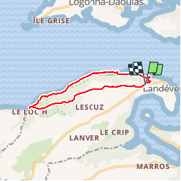
Trail Walking of 10.8 km to be discovered at Brittany, Finistère, Landévennec. This trail is proposed by jmrobin.
Positioning
Country:
France
Region :
Brittany
Department/Province :
Finistère
Municipality :
Landévennec
Location:
Unknown
Start:(Dec)
Start:(UTM)
405050 ; 5349752 (30U) N.
Comments