


Rando Aiguilles de Bavella

Fab-Oz
User
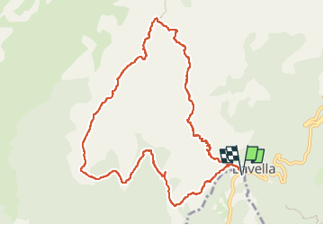

Length
12.1 km

Max alt
1730 m

Uphill gradient
821 m
Km-Effort
23 km

Min alt
1009 m

Downhill gradient
822 m
Boucle
Yes
Creation date :
2025-06-07 06:45:32.548
Updated on :
2025-06-07 11:37:01.938
4h29
Difficulty : Very difficult

FREE GPS app for hiking
 SityTrail
IGN / Geographical institutes
SityTrail Plus
The world is yours!
About
Trail Walking of 12.1 km to be discovered at Corsica, South Corsica, Zonza. This trail is proposed by Fab-Oz.
Description
Au départ du col de Bavella, montée par la variante Alpine
Redescente sympathique dans la forêt pour rejoindre le GR20
Positioning
Country:
France
Region :
Corsica
Department/Province :
South Corsica
Municipality :
Zonza
Location:
Unknown
Start:(Dec)
Start:(UTM)
518638 ; 4627122 (32T) N.
Comments