


signy le petit. 2025.06.07

trusgnachjf
User

Length
21 km

Max alt
321 m

Uphill gradient
333 m
Km-Effort
26 km

Min alt
242 m

Downhill gradient
333 m
Boucle
Yes
Creation date :
2025-06-07 07:53:49.173
Updated on :
2025-06-07 15:33:27.462
7h38
Difficulty : Very difficult

FREE GPS app for hiking
 SityTrail
IGN / Geographical institutes
SityTrail Plus
The world is yours!
About
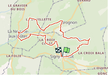
Trail Walking of 21 km to be discovered at Grand Est, Ardennes, Signy-le-Petit. This trail is proposed by trusgnachjf.
Positioning
Country:
France
Region :
Grand Est
Department/Province :
Ardennes
Municipality :
Signy-le-Petit
Location:
Unknown
Start:(Dec)
Start:(UTM)
591882 ; 5528674 (31U) N.
Comments