


suuntoapp-Hiking-2025-05-28T14-23-37Z

jcolonnadelega
User
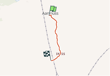

Length
6.5 km

Max alt
2447 m

Uphill gradient
541 m
Km-Effort
11.9 km

Min alt
1912 m

Downhill gradient
12 m
Boucle
No
Creation date :
2025-06-07 17:08:06.712
Updated on :
2025-06-07 17:11:52.749
2h42
Difficulty : Medium

FREE GPS app for hiking
 SityTrail
IGN / Geographical institutes
SityTrail Plus
The world is yours!
About
Trail Walking of 6.5 km to be discovered at Béni Mellal-Khénifra, cercle d'Azilal, Tabant. This trail is proposed by jcolonnadelega.
Positioning
Country:
Morocco
Region :
Béni Mellal-Khénifra
Department/Province :
cercle d'Azilal
Municipality :
Tabant
Location:
Unknown
Start:(Dec)
Start:(UTM)
738180 ; 3500094 (29R) N.
Comments