


Magny Vernois, ois de lantenot et de belmont

francislassauce
User
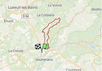

Length
43 km

Max alt
476 m

Uphill gradient
617 m
Km-Effort
52 km

Min alt
285 m

Downhill gradient
617 m
Boucle
Yes
Creation date :
2025-06-09 08:27:01.742
Updated on :
2025-06-09 12:43:31.932
4h16
Difficulty : Very difficult

FREE GPS app for hiking
 SityTrail
IGN / Geographical institutes
SityTrail Plus
The world is yours!
About
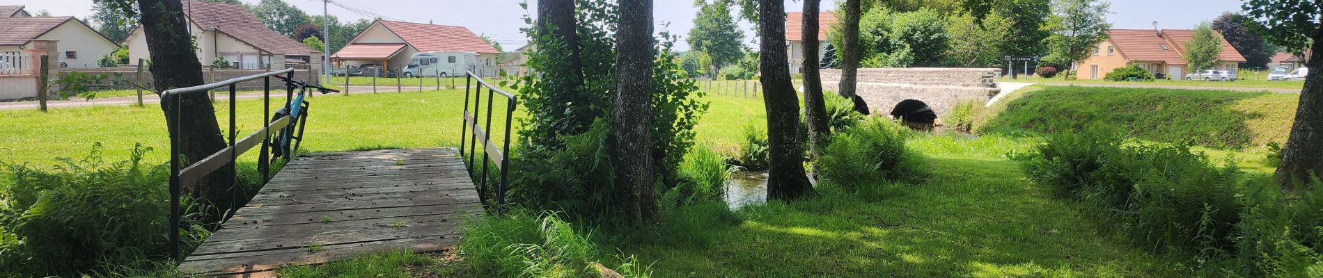
Trail Mountain bike of 43 km to be discovered at Bourgogne-Franche-Comté, Haute-Saône, Magny-Vernois. This trail is proposed by francislassauce.
Photos


Positioning
Country:
France
Region :
Bourgogne-Franche-Comté
Department/Province :
Haute-Saône
Municipality :
Magny-Vernois
Location:
Unknown
Start:(Dec)
Start:(UTM)
310418 ; 5282510 (32T) N.
Comments