


chasse maree pourville

olivieraron
User
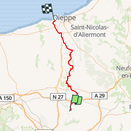

Length
55 km

Max alt
166 m

Uphill gradient
801 m
Km-Effort
66 km

Min alt
6 m

Downhill gradient
884 m
Boucle
No
Creation date :
2019-01-14 09:40:45.451
Updated on :
2019-01-14 09:40:45.496
1h40
Difficulty : Unknown

FREE GPS app for hiking
 SityTrail
IGN / Geographical institutes
SityTrail Plus
The world is yours!
About
Trail Other activity of 55 km to be discovered at Normandy, Seine-Maritime, Clères. This trail is proposed by olivieraron.
Positioning
Country:
France
Region :
Normandy
Department/Province :
Seine-Maritime
Municipality :
Clères
Location:
Unknown
Start:(Dec)
Start:(UTM)
363438 ; 5495728 (31U) N.
Comments