


lac de saint cassien

Canard83
User
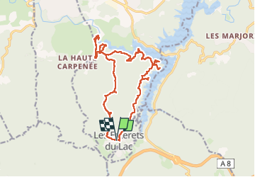

Length
21 km

Max alt
346 m

Uphill gradient
481 m
Km-Effort
27 km

Min alt
112 m

Downhill gradient
487 m
Boucle
Yes
Creation date :
2025-06-09 07:22:50.974
Updated on :
2025-06-09 14:30:32.207
7h07
Difficulty : Medium

FREE GPS app for hiking
 SityTrail
IGN / Geographical institutes
SityTrail Plus
The world is yours!
About
Trail Walking of 21 km to be discovered at Provence-Alpes-Côte d'Azur, Var, Montauroux. This trail is proposed by Canard83.

Positioning
Country:
France
Region :
Provence-Alpes-Côte d'Azur
Department/Province :
Var
Municipality :
Montauroux
Location:
Unknown
Start:(Dec)
Start:(UTM)
320834 ; 4824483 (32T) N.
Comments